Mapping a New Home
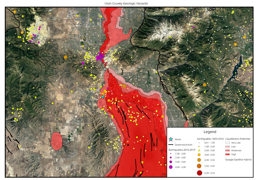
My friend was in the market for a new home and knowing my background with geology asked me where a suitable place was to build in the Wasatch Valley. I got to work on gathering sources and data to come up with a map that I could share with them to show the potential geologic hazards around some potential home sites.
Hazard Map:
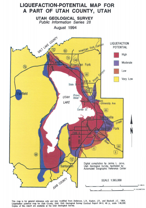
A few options were by Utah Lake which is along the Wasatch Fault Sytem. Proximity to the water table mixed with seismic activity means liquefaction can be a real possibility. The Utah Geological Survey hosts various hazard maps and resultant GIS data sets that can be used. The geologic data sets come with a disclaimer of accuracy since many of the current GIS data sets are digitzed from older geologic studies.
Utah County Liquefaction Potential Publication:
GIS Data Portal:
Utah Liquefaction Potential GIS Data
Once I acquired the liqeufaction data I also needed to acquire the historic and recent earthquake data which the United States Geological Survey (USGS) provides.
I pulled all the data together in QGIS and symbolized it accordingly and this was the end result:
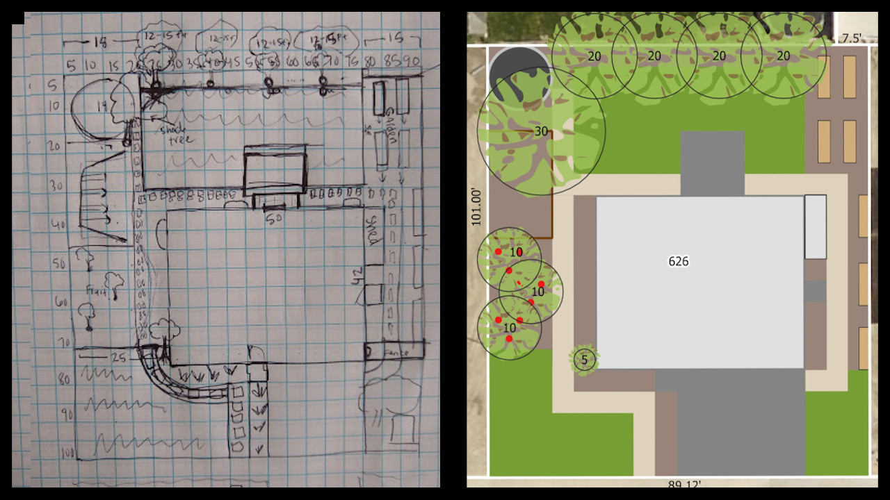
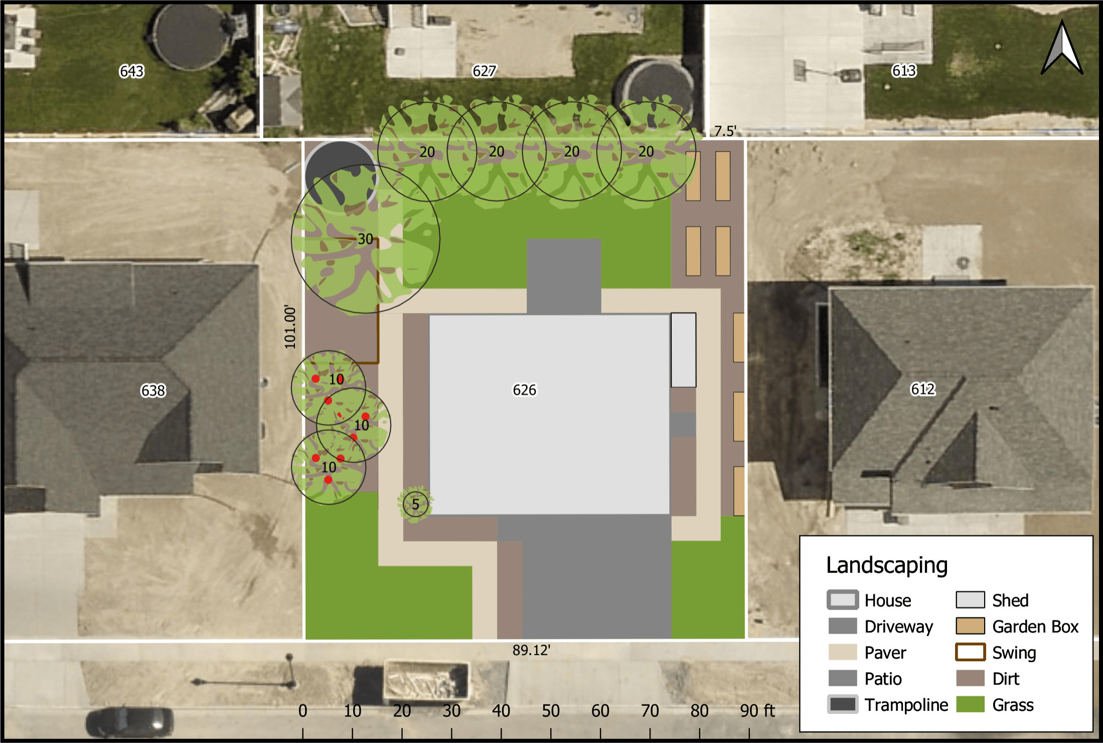
Landscape Map
A few months later my friend found a suitable location they were happy with and knowing my backround with my landscaping work at my university, they showed me their hand drawn landscaping plans. It was a nice sketch but for their new home I thought they should have something a bit more tailored so I got to work on drafting up a map.
First I pulled their deed and original plat map for their development to make sure that what they measured out reflected the legal boundaries of their property.
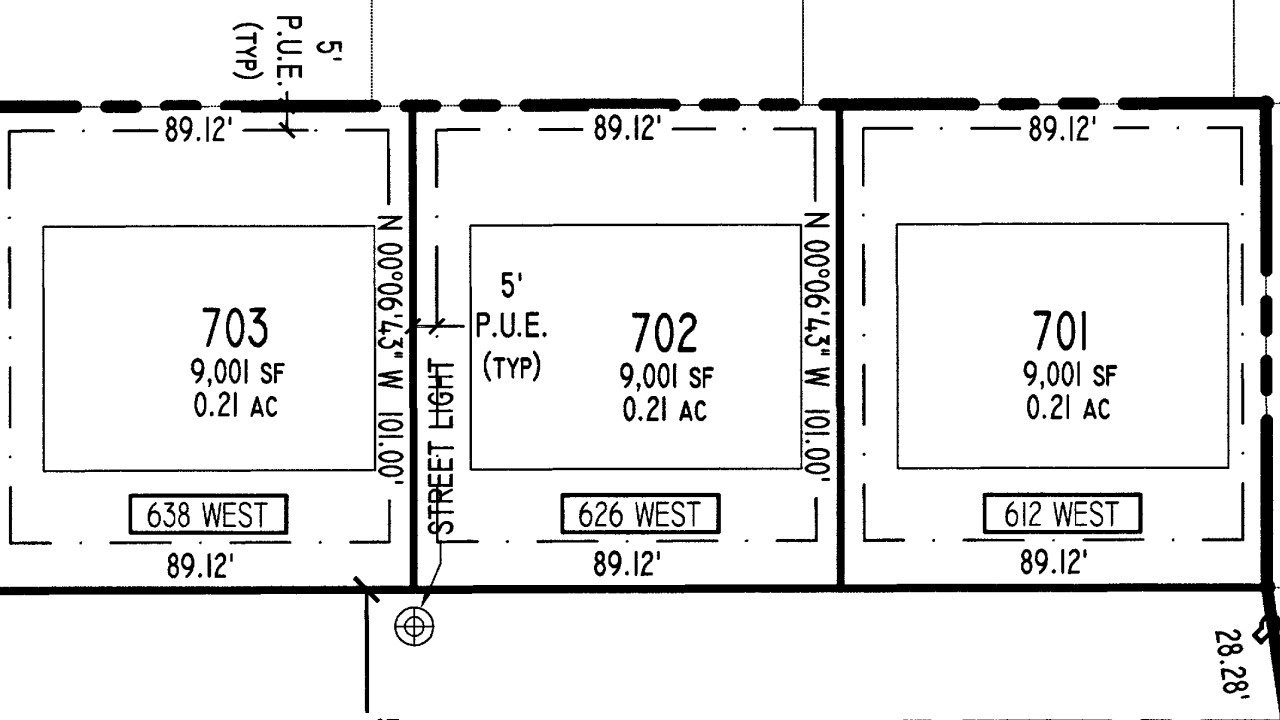
Once I verified the measurements were correct I opened up QGIS and pulled in some updated aerial imagery from Google and overlaid the county parcel data that reflected the recorded plat. Then it was just a matter of recreating the hand drawn sketch.
This was the final result:
Future
I would like to revisit this in a few years once the plants have grown and the satellite imagery of the area has been updated to see how closely my map reflects reality.