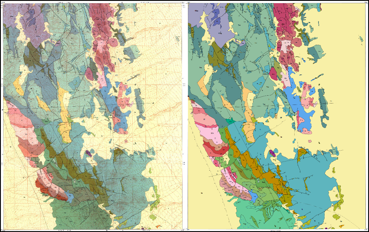
Geologic Maps
The first opportunity I had to do real GIS work was with the Utah Geological Survey digitizing geologic maps. I worked with Zach Anderson in the Geologic Mapping group. He was very knowledgeable and had a clever process for digitizing that used rule-based topologies to ensure accuracy. It was a volunteer project but I was able to acquire college credit for completing it.
The area I digitized covers 4 standard quadrangles (Lopers Spring, Sawtooth Peak, Miners Cabin Wash, and Buckhorn Spring) I’ve included links to the original publication, completed GIS data, and REST service.
Mountain Home and Indian Peak Range Publication
Mountain Home and Indian Peak Range GIS Data
Mountain Home and Indian Peak Range Rest Service
I also generated an openlayers web map of my work:
I worked on a few projects with them and the following summer of 2015 I was able to do an internship at the Utah Geologic Survey under Marshall Robinson helping him convert the old HTML based website into a modern Wordpress content management system.
Utah Geological Survey Website
Marshall was great to work under and was patient with my lack of experience in web development. He encouraged me to figure things out on my own and in the end we came up with something to be proud of. Marshall has done a great job building and maintaining the UGS site, it’s definitely one of if not the best geological survey website in the United States.
My internship helped set me on my current professional path. I would have loved to work there permanently but some other opportunities came up that took me elsewhere.